This article is more than 1 year old
Lochs, rifle stocks and two EPIC sea gates: Thomas Telford's Highland waterway
Feats of engineering, projections busted - the Caledonian Canal
GEEK'S GUIDE TO BRITAIN The Highlands are home to spectacular hills and mountains. You'll also find dotted around some fairly unusual engineering projects that have endeavoured to conquer them.
One of the oldest and most enduring of these grand projects is the Caledonian Canal, which cuts across 96km (60 miles) of Scotland from Inverness to Fort William. It’s an epic work with an epic history.
Surveyed in 1773, the canal was envisioned as a way for Royal Navy ships to move from east to west, avoiding the violent seas and winds off Cape Wrath and through the Pentland Firth.
It was also a vast employment scheme used to keep workers in the Highlands, an area suffering a regional exodus.
It was an act of Parliament that sanctioned construction, with a budget of £474,000, making the Caledonian Canal the nation’s first publicly funded transport infrastructure project.
Bad weather, tough terrain and engineering challenges meant that the canal went massively overbudget – to the tune of £910,000 – and took nearly twice as long as forecast – 12 years rather than the initially calculated seven – to complete.
Napoleon was long gone, too – beaten twice over, forced to retreat from Russia and decisively beaten in Belgium in 1815.
That aside, the Caledonian Canal was a remarkable achievement. It combines four lochs and man-made waterways that comprised what was then the world’s largest lock gate system. The project necessitated the diversion and the raising of one of the natural lochs, Lochy, it employed 3,000 labours, and it saw development of steam dredger - rare machine in Scotland at that time – for completion.
Scotland, never mind Britain, have may locks - but few like this one. What’s more, following its course is easy.
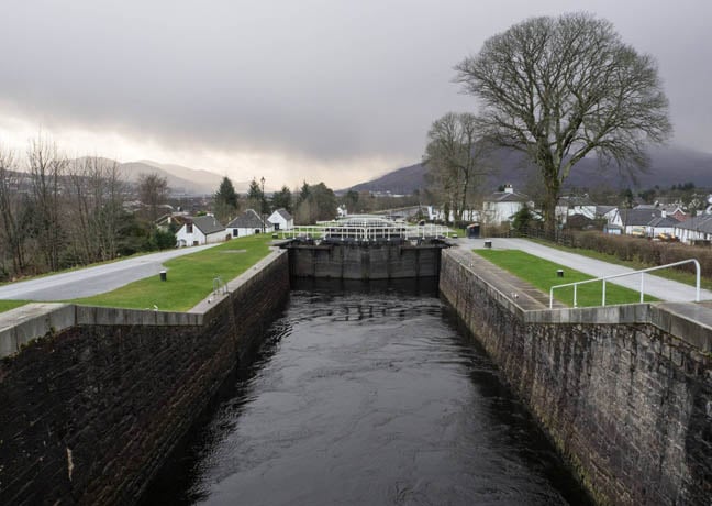
I started my particular journey near one of the Canal’s most notable and challenging constructions: Clachnaharry Sea Lock, a stone’s throw west of Inverness proper and opening on to Beauly Firth.
Thomas Telford was the project’s principal engineer, and on this part of the project he noted that new methods had been required to build the all-important box for the gates that would be needed take to the canal to its desired depth of 6.1 metres (20ft).
Being intended to take sea-faring warships, the canal had a specification larger than others in the country at that time: a width of 33.5m (109.9ft) at the surface and 15.2m (49.8ft) at the bottom.
Two headlands were built to form part of the Clachnaharry gate system, but the soft and shifting sea mud at the base made it impossible to build the cofferdam that was vital to work on the base of the gate box itself. So a bridge of clay and rocks was placed between the two new headlands and allowed to sink into the deep and viscous ooze over a period of six months until it sunk to a depth suitable for work to begin. A pit was dug to a depth of 9.1m, drained of water and filled using a mix of rubble and mortar to form the foundation upon which the lock-gate box could be built.
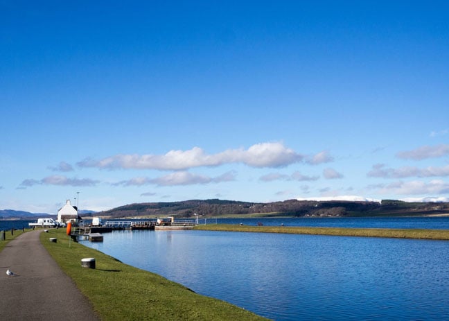
Clachnaharry Sea Lock: an epic work itself that demanded new construction techniques, photo credit: David Spooner
I set off on foot for Muirtown Basin and Locks, a mile away. The northernmost part of the canal, Muirtown Basin, is home to a vast marina with a wealth of vessels of all sizes present, from tiny pleasure craft to luxury cruisers.
From the marina, vessels undertaking the journey must first navigate the Muirtown swing-bridge, one of eight along the waterway – seven for road traffic and the eighth for trains.
This particular bridge was built in 1935 and is electronically operated, replacing the original structure that had been in place since the time of the original construction in 1816. Opening and closing in a remarkably quick fashion, the bridge operates in such a way as to cause minimal disruption to the road it bears.
Following several kilometres of canal, I ascended a group of locks that bring the canal up to the height of Lochs Dochfour and Ness, 16 meters (52.4ft) above sea level.
The A82, following the north shore of Loch Ness, is the quickest and most common route to Fort William but in my writer’s opinion by far the more attractive route is to take the B852 that runs along the south shore.
Towards the southern end of the loch the road diverges from the water, heading in to the hills before rewarding the traveller with a much-elevated view of Fort Augustus and the next stretch of purpose-built waterway. The view here gives you a sense of just what an undertaking the construction of the canal was.
As you descend down in to Fort Augustus the hills flanking Loch Ness appear to grow in height and loom over the village, giving weight to the Great Glen moniker. Visitors are well-catered for here, with more places to eat or stay than you’d expect for a settlement of fewer than 700 residents. We resisted the urge to indulge in a bacon sandwich and a cup of tea, however, and explored the canal.
The waterway leaves Loch Ness for the next stretch of man-made channel. Centrally located in the village is the next staircase-lock on the canal, where five gated locks once more lift the canal and its passengers to bring it to roughly the same elevation as Loch Oich. From here it’s onto Fort Augustus with its five lock gates.
At Fort Augustus, a small visitor’s centre provides a glimpse in to the past with a few artefacts on display. The Clansman Centre offers a nice place to pick up gifts and trinkets and provided a window in to the region’s history; the centre’s website offers a similarly fascinating glimpse into the past, having appeared to have been transplanted directly from the late '90s (check out the awesome sword gifs!).
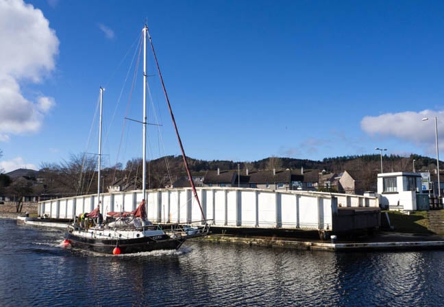
One of eight: Muirtown swing-bridge from 1935 replaced the 1816 original
It’s a good opportunity to take stock.
You can thank inventor and engineer James Watt for all of this. Credited with shaping the British industrial revolution having refined the idea of the steam engine, it was Watt who originally surveyed the canal.
The plan had been for a 97km (60.2-mile) system but with 60km (37.2 miles) running through a series of lochs – Dochfour, Ness, Oich and Lochy – that left just 37km (22.9 miles) to build. The 29 gates it needed were then the world’s largest at 55m (180.4ft) long, 12.1m (39.6ft) wide and between 7.7m (25.2ft) and 6m (19.6ft) in depth.
When in 1803 the project re-emerged, it fell to renowned engineer Thomas Telford to pick up.
The son of a shepherd who died before he was born, Telford was a rising star in civil construction whose legacy is today stamped across the UK. Telford built a sizeable chunk of the man-made Highlands, including 920 miles of roads and 120 bridges – not to mention many harbours and bridges in the rest of Scotland. He was a natural choice for the British government to complete the canal.
The series of locks that punctuate the length of the canal were the vital component that would allow for its construction. It was clear that concentrations of densely packed locks would be the most efficient way of dealing with elevation changes, but they are complicated to build, even more so given their planned size, and location in the centre of the logistically challenged Highlands. The Laggan system between Lochs Lochy and Oich is the canal’s highest point - 32.2 metres (105.6ft) above sea level.
Telford had estimated a built of seven years and sum for the project of £474,000 - a formidable amount at that time but such was the pressure from the Royal Navy plus the political will to provide employment in a region suffering after the Highland Clearances the government passed the act on expenditure.
With funding in place, Telford began construction. Work was to begin at both ends simultaneously, the aim being to not only to speed things up but to also facilitate the moving of construction material, as vessels would be able to bring supplies to site by using already completed portions of waterway before eventually connecting up towards the middle of the Great Glen.
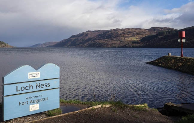
60km of canal runs through four lochs, including the infamous Ness
As work on the canal got under way, it soon became apparent that Telford’s estimates of both time and money were dreadfully optimistic. A severe shortage of skilled engineers and workers, along with labourers who had to leave the project to tend to harvests, played no small part in causing delays. These shortages led to large numbers of Irishmen being brought over to make up the numbers – a somewhat ironic turn of events, given that a key reason for the project had been to provide employment for the locals.
No amount of imported labour could write off the geological problems, such as that sticky sea mud at Clachnaharry that was up to 16.8m (55.1ft) deep that took a year and a half to overcome.
After admiring the Fort Augustus’s locks and dodging a rain shower, we joined the A82 and made for Loch Oich, the highest point of the Canal. Here we stop to admire the lightweight suspension bridge built in 1854 by James Dredge. The bridge employed a then-new, double cantilever chain support by massive pylons, of granite, on either shore and anchored into the ground. Dredge built 50 bridges of this type and Oich is the best surviving example in Scotland. The bridge carried road traffic until 1932 when the A82 was sent across the nearby three-span concrete structure that we’re using.
Dredge’s bridge can be crossed but it no longer leads anywhere, so we continued on our way down the shore of Loch Oich.
It's a relatively small loch, and we soon found ourselves alongside the canal proper again – a short, one-and-a-half mile stretch linking Loch Oich with Loch Lochy.
Pulling up in a large lay-by that sits on the edge of Loch Lochy and looking up at the towering peaks of Meall Dubh, Meall Coire Lochain and Meall na Teanga is a timeless affair. With no sign of modernity in sight, but for the road at their backs, a visitor can look across the water at the hills and with but a little imagination picture a flotilla of construction vessels. Indeed, even a cutting-edge, custom-built, steam-powered dredger had been brought in in an effort to fulfil Telford’s plan for a 6m(20ft) draught, a smoke-billowing beast that would have been unlike anything the area would have seen before.
Taking this in, after a while we realise we’re hungry only a catering van in the lay-by is shut and the decision to avoid having a cup of tea at Fort Augustus is soon regretted. If you’re planning to stop and admire the view repeatedly, it’s worth topping up while you have the chance!
Oh well. At the southern end of Loch Lochy the waterway enters the longest man-made stretch along the route of the canal. The level of the loch was artificially raised by Thomas Telford by a height of 3.7 metres and diverted to take advantage of the existing river bed.
So as not to lose sight of the canal, we turned off the A82 on to the B8002 at the Commando Memorial, stopping there for a time to take it in.
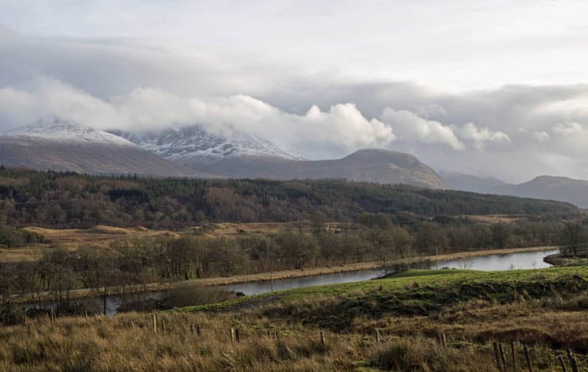
The Canal with Ben Nevis: epic terrain helped double the project's price and delivery time
This is 5.8m (17ft) tall statue of bronze and stone, the memorial remembers 1,700 Commandos who fought and lost their lives during WWII. It is an imposing yet humbling sight, three tall figures in their fatigues and slung rifles, forever looking across the hills.
The commando unit was created on the orders of PM Winston Churchill in 1940 as an elite force and their basic training camp was established at Achnacarry Castle in 1942. Trainees would arrive at Spean Bridge railway station following a 12-plus hour journey and step off for a 11km march uphill to the castle (that is still standing, but closed to the public) while carrying 15.87kg (35lbs) of equipment.
Anyone who failed to make the march within 60 minutes was immediately returned to their unit – as clear an introductory notion as any that only the fittest would succeed.
Moving on, we found ourselves on the north side of the canal, looking south across to Ben Nevis, Britain’s highest mountain and its nearby cousin Aonach Mor.
When it was finally opened in 1822, the canal was more than a decade late and the budget had doubled. To deliver it at all, Telford’s plans had actually been curtailed to save costs but it was a false economy that left the planned 6.1m (20ft) draught at just 4.2m (14ft), making it too shallow for the newer generation of boats coming into widespread use. Defects in the construction materials, meanwhile, resulted in a partial collapse of the locks at Corpach and canal bank at Cullochy.
Repairs were conducted between 1843 and 1849 and dredging took the canal to a new depth of 5.2m to take vessels with a draft of 4.9m, although it was something of an arms race: even larger ships were coming online, trading in the Baltic, meaning more and more shipping was using the coastal route rather than cutting across land via the Caledonian.
Being in the shadow of Britain’s highest mountain, however, does reinforce the harshness of the land through which these epic labours took place - an observation soon demonstrated perfectly as the fact that the road brings you to the car park beside the massive complex of locks known as Neptune’s Staircase: eight individual locks combine with the aforementioned Corpach Sea Lock to lower the canal one final time in to Loch Linnhe, an inlet of the Firth of Lorne and ultimately the Irish Sea.
Neptune's Staircase: among the country's largest system of lock gates
The eight locks of Neptune’s Staircase stretch over 400 metres, making them one of the longest combinations in Britain, and take around 90 minutes to traverse. At a size of 51.8m (170ft) by 12.1m (40ft) each, the locks remain amongst the largest in the country. It was two of these locks that collapsed in 1843, sparking years of repairs with dredging to a depth of up to 5.2m (17ft), making navigation impossible while the work and modifications were carried out.
Jumping forward, extensive work carried out in the 10 years from 1995 reinforced the lock walls at Neptune’s Staircase, ensuring its survival in coming decades.
Tourism has helped the entire canal survive to this day and draws countless visitors every year. The catalyst was, arguably, Queen Victoria, who in 1873 undertook a highly publicised trip along the waterway. It was this act that brought this rather picturesque route to the attention of tourists from the south. The number of pleasure-seeking visitors soared and the arrival of the railway in Inverness and Fort William – far from damaging passenger numbers – actually helped them soar further, with train and steamer services timed to coincide with each other as visitors looked to emulate the queen’s journey.
Sadly, for us, the weather closed and obscured our view of this final portal through which a vessel must travel before it leaves the canal for open water. We instead sought refuge and hot food in The Moorings restaurant and hotel adjacent to the car park, overlooking Neptune’s Staircase. Our return journey to Inverness took less than two hours.
We’ve arrived here via a series of roads and tracks. It took hours, but it’s impossible to imagine the complexity of our journey and the time this would have taken more than 200 years ago. And that was dry land.
It's worth sparing a thought, then, for the sea journey, how long that trek around the coast from Inverness to Fort William might have taken, and in the age of sail and in inclement weather.
Consider that, and you can get a feel for what drove the construction of this engineering wonder. ®
GPS
Clachnaharry Sea Lock Sealock House: 57.490298, - 4.262799
Neptune’s Staircase: 56.846838, -5.093949
Getting there
Public transport: Inverness and Fort William have excellent train and rail links.
Car: From Inverness: B862 from Inverness to the B852 at Dores, signposted to Inverfarigaig and the Loch Ness Trail. Rejoin the B862, towards Fort Augustus, A82 to Fort William. At Fort Augustus, B8004 to Gairlochy, just before the Commando Monument then head for Neptune’s Staircase in Fort William.
Entry
Open to the public. Caledonian Canal Visitor Centre, Fort Augustus: Monday - Friday, 9am - 5pm. Entry: free.
